
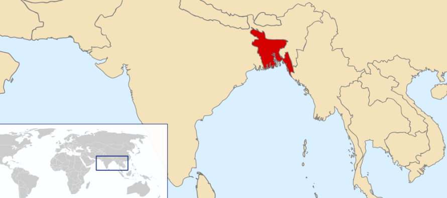
Bangladesh – India Sea Boundary: Ways to resolve the issue
The three-day Bangladesh-India maritime boundary talks ended in Dhaka on 17th September without making any concrete progress on the pending issues, although officials of both the countries claimed to have had ‘fruitful discussions’ after almost three decades.
The leader of the Indian team, Rear Admiral BR Rao, said that it was a technical meeting and more discussions would follow. ‘We had a wonderful discussion. We discussed various options and methodologies [of delimitation of the maritime boundary],’ he reportedly said.
Incidentally this is the first time that the India’s team was led by a naval Rear Admiral officer. In all previous discussions, India’s technical team was led by the Legal Adviser of External Affairs Ministry and later the official level talks by Secretaries
1982 UN Convention on the Law of the Sea (UNCLOS):
Bangladesh ratified the UNCLOS in 2001 and accordingly Bangladesh’s law, the Territorial Waters and Maritimes Zones Act of 1974 that was enacted, long before the UNCLOS needs to be updated in line with the provisions of UNCLOS.
It is argued that Bangladesh’s case is much stronger under the 1982 UNCLOS than that of India ( see Articles 74 and 83 related to the delimitation of economic zone and continental shelf)
What are the issues?
There are four issues involved in the maritime boundary:
(a) Determination of the Hariabhanga border river boundary (South Talpatty Island is to be taken into account in delimiting the boundary),
(b) Determination of boundary of territorial waters up to 12 miles
(c) Determination of boundary of exclusive economic zone of another 188 miles from the end of territorial waters
(d) Determination of boundary of continental shelf (sea bed) up to approximately 350 miles from the coast..
Brief history of earlier talks:
The first session took place in 1974 in Dhaka at the official level.. Later several meetings took place at the level of Foreign Secretaries. (The writer was a member of Bangladesh delegation at all the sessions of discussion from 1974 to 1978).
When Foreign Secretaries could not resolve the differences, it was elevated at the Foreign Ministers’ level in 1975 and the Ministers from Bangladesh and India considerably narrowed down the difference.
Meanwhile there was change of government in August 1975 in Dhaka and within two years, in New Delhi, Janata Party government led Morarji Desai replaced the Congress government of Indira Gandhi in 1977.
Another session took place in 1978 but India took the stand that whatever decisions were taken by the Ministers in 1975 would not stand. The India’s decision was disappointing to Bangladesh.
The last talks on the issue took place in 1982 and were inconclusive
Boundary for Hariabhanga River
On the Hariabhanga river boundary issue, it is suggested that the mid-flow (deepest channel) of the river is to be made a fixed boundary on the river, described in geographical coordinates, as is the case between Bangladesh and Myanmar on the Naaf river.
If a fixed boundary is determined, the boundary will not change with alteration of the mid-flow of the river.. Innocent river navigation will be allowed on the mid-river flow of both countries.
It is suggested that all river-boundaries between India and Bangladesh (such as Muhuri river in the east) should also be fixed boundaries delineated by geographical coordinates so that problems or disputes do not arise if a river changes its course.
South Talpatty Island:
The disputed U-shaped South Talpatti island is supposed to have emerged after the 1970 cyclone. Most of it is understood to be a low tide elevation of about 2 kilometres… It is located about 4 kilometres south of the Hariabhanga river (Latitude 21 degrees, 36.0 north, Longitude 89 degrees, 09.10 east)
The ownership of the island depends on which direction the mid-flow pass by the island. If the mid-flow goes west of the island, it will belong to Bangladesh,
The direction of the mid-flow (deepest channel ) of the river Hariabhanga can be easily found if a joint Indo-Bangladesh survey is conducted on the river. Bangladesh proposed joint survey as early as 1974 to India and but no positive response came from India.
Three suggested ways to resolve this issue:
I would suggest any one of the three alternative ways to address the issue:
(a) Commencement of political level discussions
(b) Refer the matter to International Arbitration Tribunal
(c) Joint development of off-shore areas until the agreement is concluded
Negotiation at a political level:
Past experience demonstrates that the matter cannot be resolved legally or technically because at the political level, the government leaders would look at the problem from a broader view of bilateral relations and are not confined to mere legal and technical niceties
The bottom line is that India’s political leaders must decide as to whether Bangladesh would get a fair and equitable share of the economic zone and continental shelf of the Bay of Bengal given Bangladesh’s unique characteristics of the coastline, such as
(a) its concavity and indented coastline,
(b) unstable waters of the coastal zones because of river -flows of the Ganges, Brahmaputra and Meghna , carrying every year 2,4 billion tons of silt to the Bay of Bengal, particularly during monsoon season.
(c) scanty natural resources in proportion to the huge population, and
(d) the general orientation of the Bangladesh’s topography facing the Bay of Bengal.
It is suggested that the Foreign Ministers of the two countries may meet and take the thread from the discussions of former Foreign Ministers in 1975 forward.
Once a decision is taken at the political level the direction the boundary line, the technical and official level discussions may take place to prepare the nitty- gritty of the sea boundary agreement.
It may be noted that when the technical level discussions on the share of the Ganges waters were going nowhere, the share was decided at a political level (between President Ziaur Rahman and India’s veteran Minister Jagjivan Ram) in April 1977 and thereafter the technical/official team met to prepare and conclude the 1977 Ganges Waters Agreement in September and was signed in November of that year.
International Arbitration:
If bilateral negotiations fail to resolve the issue, it is appropriate to refer the issue to an International Tribunal for arbitration as India and Pakistan referred the Rann of Kutch boundary issue to an International Arbitration Tribunal in 1966.
Bangladesh at one stage in 1975 proposed to India that the issue might be resolved through a decision of an international arbitration but India was not responsive to it.
Bangladesh may again propose the same, given the urgent need to explore the maritime areas for oil and gas exploration in the Bay of Bengal.
Joint Development:
Ordinarily, the delimitation of maritime boundary takes a long time and if there is an issue of overlapping maritime areas that remains disputed and unresolved, the experience and lessons of many states are one of cooperation to a provisional agreement of joint development and exploration of resources in off-shore areas.
The idea of joint development of off-shore oil and gas is not new and dates back to the judgment of the International Court of Justice in the North Sea Continental Shelf of 1969. At that time, the Court referred to the possibility of parties deciding on “a regime of joint jurisdiction, use or exploitation for the zones of overlap or any part thereof.”
Examples of Joint Development Agreements:
Saudi Arabia-Bahrain Agreement of 1958, Kuwait-Saudi Arabia Agreement of 1965, Iran-Sharjah Agreement of 1971, Japan-South Korea Agreement of 1974, France-Spain Agreement of 1974, Iceland-Norw
ay Agreement of 1974, Saudi Arabia-Sudan Agreement of 1974, Australia-Papua New Guinea Agreement of 1978, Malaysia-Thailand Agreement of 1990 and Thailand-Vietnam Agreement of 1992 on Joint Development Zones, are some of the instances in point.
Furthermore in 2006, China and southern neighbour Vietnam agreed to increase joint oil and gas exploration efforts in the Gulf of Tonkin. It is reported that on 18th June, 2008, Japan and China struck a landmark deal to jointly develop gas field in the East China Sea, resolving a spat that has been a thorn in ties between the two major energy importers
Conclusion:
It is suggested that all these measures enumerated in the foregoing paragraphs need to be considered by both countries on a priority basis.
Bangladesh and India are neighbours and friendly countries. There is no adequate reason why the maritime boundary issue cannot be resolved between them as other neighbouring countries have done across the world.
By Barrister Harun ur Rashid
Former Bangladesh Ambassador to the UN, Geneva.
